The best views on the Ha Giang Loop Map are not to be missed for those keen for an adventure on a motorcycle.
DISCLOSURE
Some of the links here are affiliate links and I may earn if you click on them, AT NO EXTRA cost to you. I hope you find the information here useful! Thanks.
Where is Ha Giang?
Ha Giang is located in the northeastern of Vietnam, 300km (186 miles) from Hanoi and 30km (19 miles) from the Vietnam-China border. It is best suited for adventure seekers and cultural explorers. The vast landscape in the mountainous terrains will leave you in awe as you witness the best of what the Ha Giang Loop map has to offer.
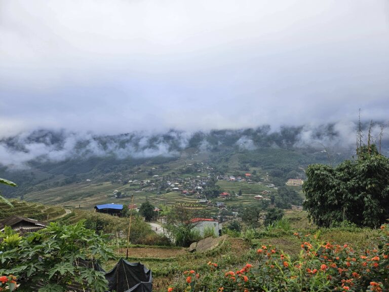
Opt to skip exploring the Ha Giang loop map if you are looking to have a close-up view of the rice paddy terraces. Instead, follow my guide and spend the next 3 days exploring Sapa.
Here’s my take: Visiting and spending 3 full days on the Ha Giang loop is not a mistake. It is one of the best decisions, despite almost giving up as I was unable to find the best easy rider package to explore the region.
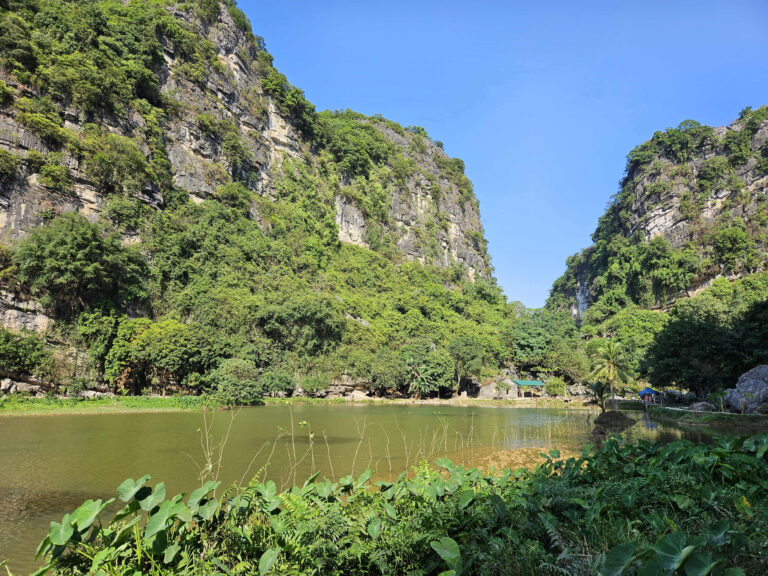
Bird’s eye view of Ha Giang from one of the lookout points
How to visit Ha Giang Loop?
The best way to get to the Ha Giang Loop is to get on a 7-hour overnight sleeper bus from Hanoi to Ha Giang. Request for the bus to drop you off at your accommodation, as the bus will arrive in Ha Giang at ~4:00 AM. There is no train towards Ha Giang.
There are two preferred options to explore the Ha Giang Loop Map: (1) with an Easy Rider; or (2) by yourself. I’ll break it down for you on how to decide between the two options.
1. With an Easy Rider
An Easy Rider is a term used by the Ha Giang Loop tour operators. Throughout the trip, you will be driven, or easily known as a “passenger princess” at the back of a motorcycle.
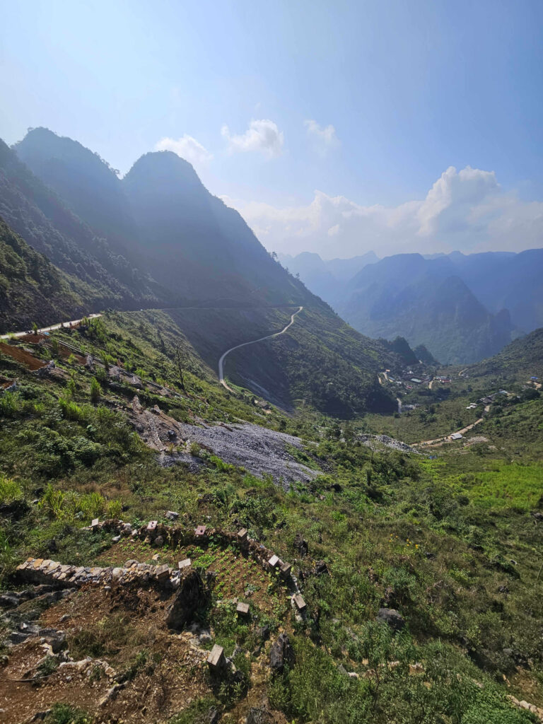
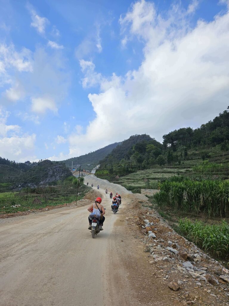
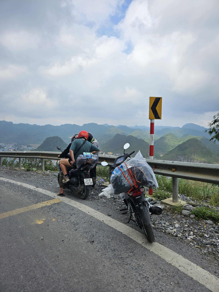
The route to enjoy the best views requires significant riding skills and experience to avoid mishaps. While the tour packages are slightly pricier, opt for this option to save the stress of navigating the gravelled and sharp-bend roads in the mountainous regions to enjoy and capture the best views of Ha Giang.
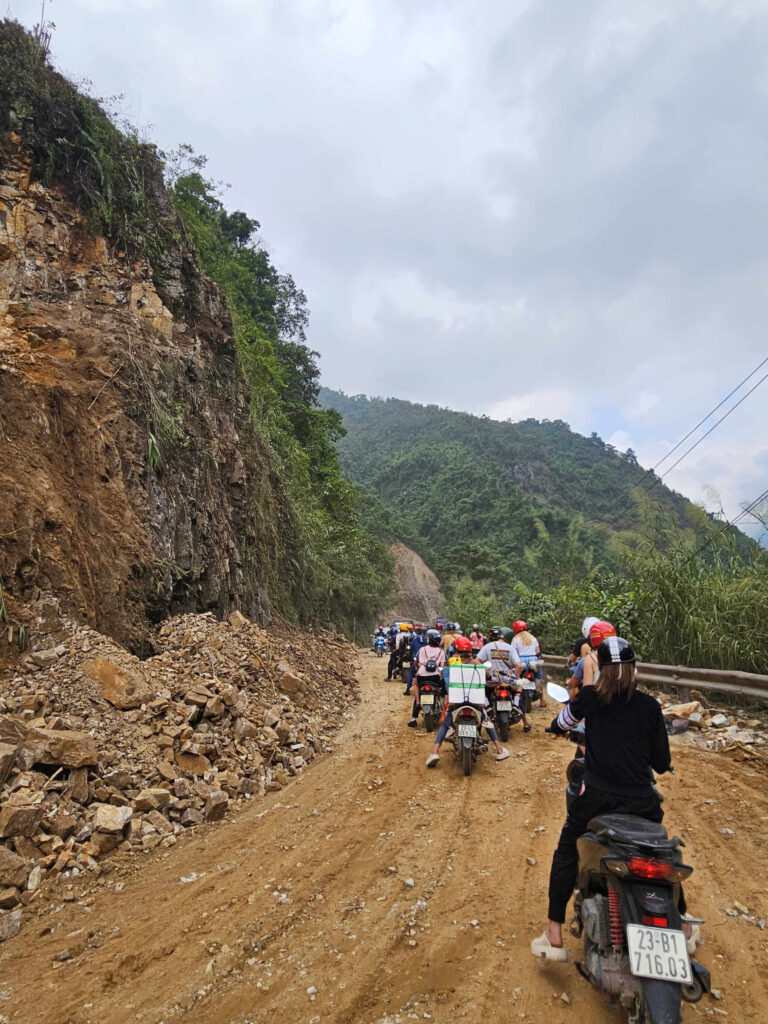
Soiled roads on some parts on the Ha Giang Loop Map
2. By yourself
Opt for this option if you tick all the items on this list:
- A valid international motorcycle license (as there has been an increasing number of accidents reported)
- Confident in riding on gravelled, dusty roads with steep inclines and sharp bends, among a large group of motorcyclists in bad weather (poor visibility and heavy rain)
- Have a group of 2-3 friends with similar motorcycle riding competency
Why the criteria, you may ask? The reason for these criteria is simple: safety. You do not want to get involved in an accident that will leave you regretting the rest of your trip over the next few weeks.
Knowing my motorcycle riding capability and wanting to thoroughly enjoy the breathtaking views, I opted for a 3-day Easy Rider tour package with Hong Hao Hostel and Motorbikes. The package includes a return bus ticket to/from Ha Giang, depending on where you are coming from and going to and 2 additional nights (a night before and a night after the 3-day tour).
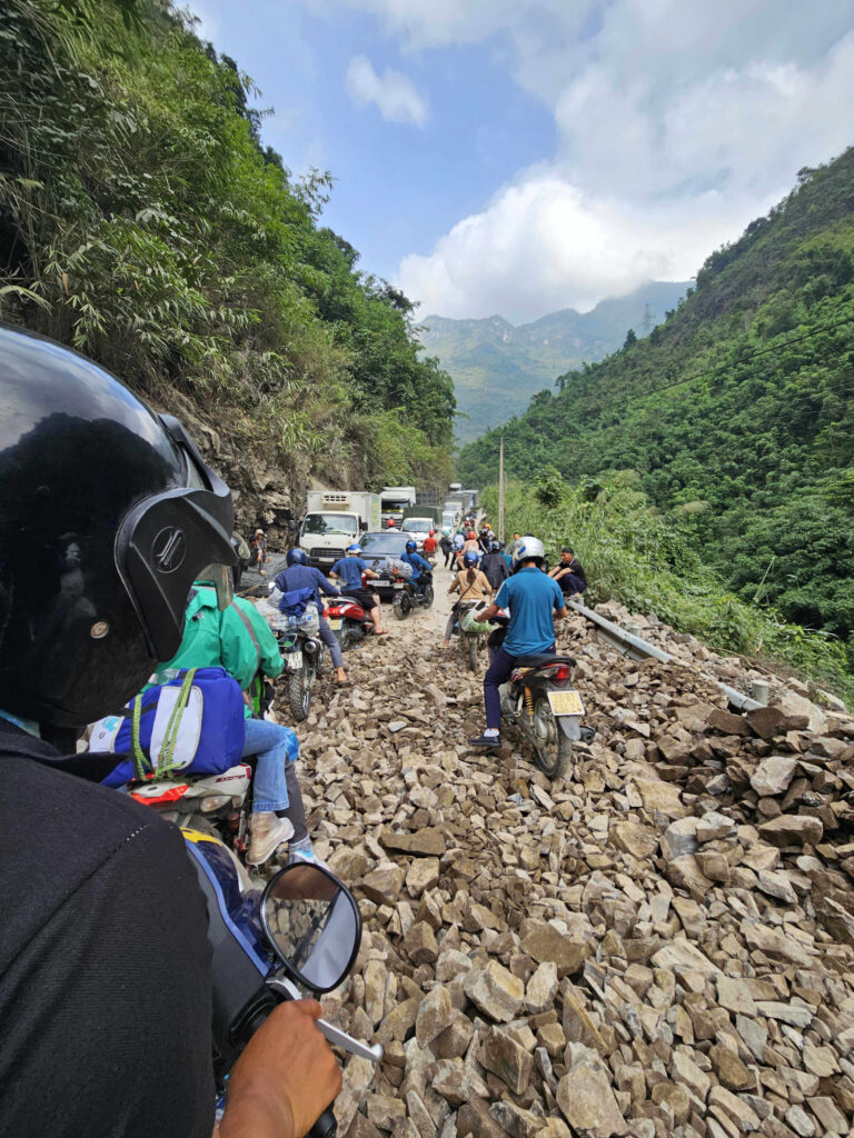
A minor landslide on the Ha Giang Loop Map, required expert riding skills to manoeuvre
What is a Ha Giang Loop Map?
The Ha Giang Loop map will give you a visual perspective on a map of the best spots to visit on the Ha Giang Loop. This will aid you in deciding how long to spend in the region. Had I found a map as such during my Google search, it would have spared me the frustration and enabled easier decision-making for an Easy Rider package.
After some time comparing the various Easy Rider packages, here are the most, if not all, the places, you must visit! From Ha Giang town, there is only a single loop, whereby most tour operators will first head northwards and then eastwards.
With my hands-on, personal experience on the road, I did not find many differences among the various tour operators, as I’ve been bumping into familiar faces at the various viewpoints. The 2 key differences that I’ve seen are: (1) group size per group; and (2) accommodation type during the trip.
Here are the places visited on the 3-day Easy Rider tour on the Ha Giang Loop Map, with the highlight of my day and places you should not miss!
Ha Giang Loop Map Day 1: Quan Ba Heaven Gate – Fairy Boom Mountain Viewpoint – Chín Khoanh ramp – Dong Van
Total ride distance: 143 km (88 miles)
Total moving travel time: 4.5 hours
Enjoy the view as your Easy Rider rides you along the Tam Son Route, with stops at Quan Ba Heaven Gate and Fairy Boom Mountain Viewpoint. Both these viewpoints boast a clear view of the villages.
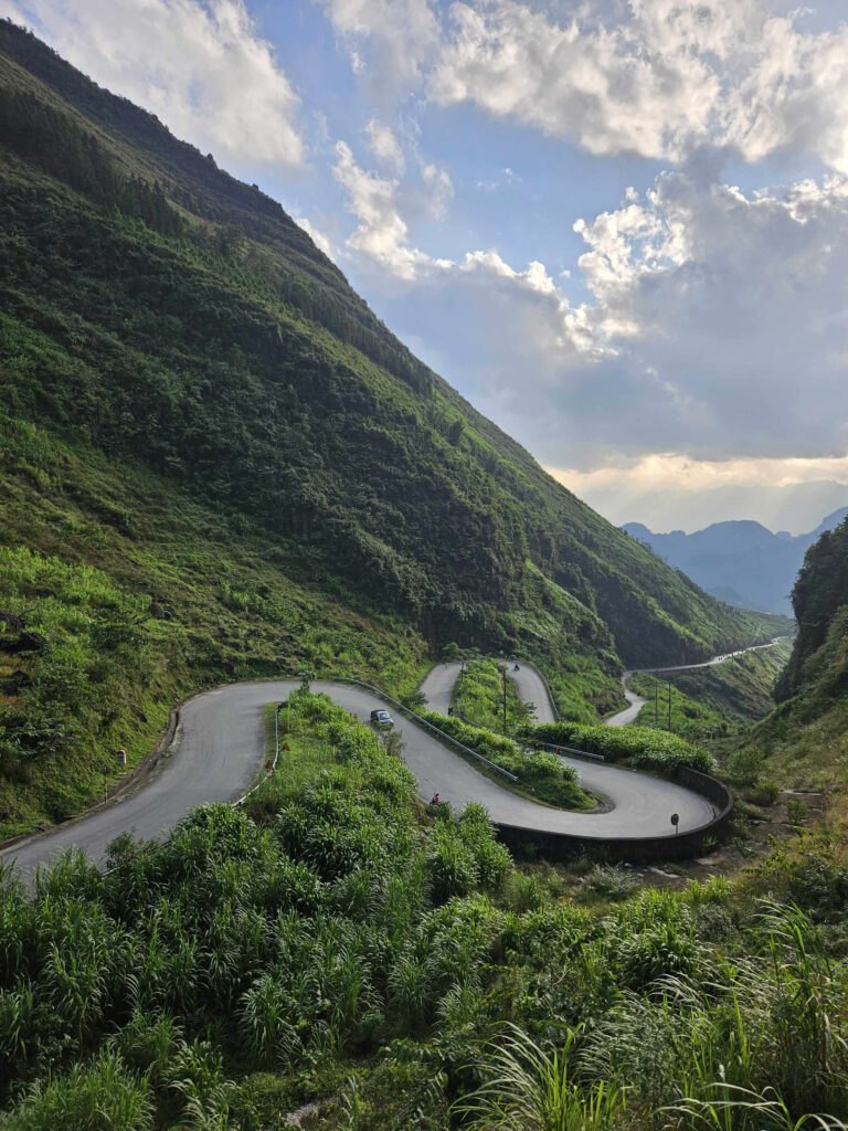
Ma Li Pang pass – THE Instagrammable spot
After another 2 hours ride along the Yên Minh Route, with a lunch break halfway through, we stopped at Chin Khoanh ramp. This was my favourite stop for the day. I witnessed how the local children work hard to sell local crafts. They were also really photogenic that I got a nice shot with one of the girls. This is THE stop to get that Instagrammable shot you often see on social media.
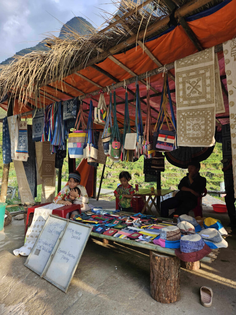
Local villages selling handmade handicraft
Ha Giang Loop Map Day 2: Dong Van – Ma Pi Leng Pass – Meo Vac – Du Gia
Total ride distance: 107 km (67 miles)
Total moving travel time: 4 hours
Although the bike ride distance was shorter than on Day 1, the travelling time took longer due to the winding and dusty roads. There were significantly more sharp bends that the Easy Riders had to manoeuvre throughout the day as we headed towards the Dong Van district.
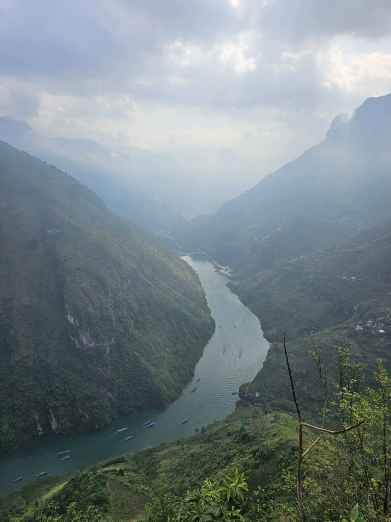
I loved the views at Ma Pi Leng Pass. Blessed with good weather, my group stopped for 30 minutes to get some photos, which is also one of my favourite photo spots. At this stop, enjoy the emerald green water of the Nho Quế River flowing through the deep valleys from Yunnan province, China.
Riding another 30 minutes downhill through the ethnic villages towards the jetty, we took a 1.5-hour cruise along the Nho Que River and through the Tu Sản Canyon. Tu Sản is the deepest canyon in Southeast Asia. The stunning view left me in awe.
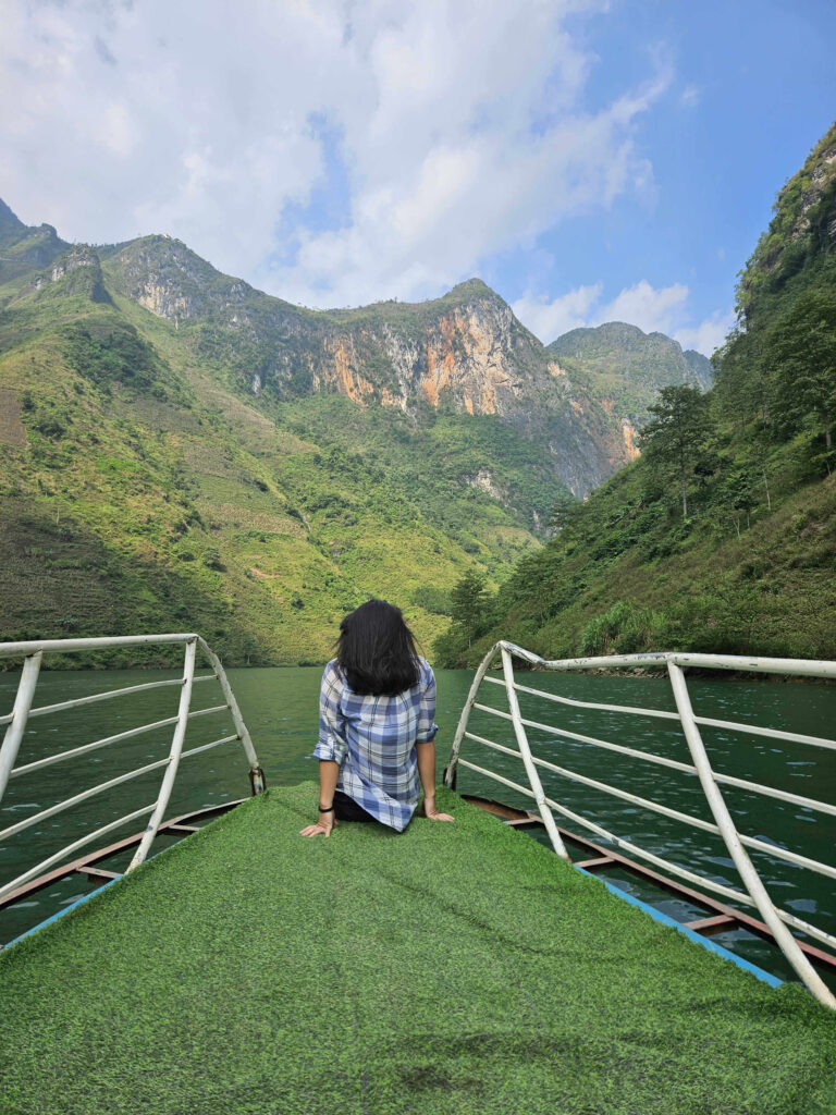
Cruising through the Tu Sản Canyon, whereby the skies cleared up as my group headed towards the jetty
There are many local stalls, selling their local delicacies. One of them is Com Lam, which is sticky rice cooked in bamboo. I tried the purple sticky rice, whereby the colour comes from natural leaves and the purple colour symbolizes fertile land. It tastes just like well-known Thai mango sticky rice, except it is not at all sweet!
Many stalls were selling the local delicacies, which is coloured sticky rice cooked slowly over charcoal in bamboo
Ha Giang Loop Map Day 3: Du Gia – Ha Giang
Total ride distance: 82 km (51 miles)
Total travel time: 3 hours
A short 5-minute bike ride from our homestay in Du Gia, our Easy Riders brought us to a waterfall for a refreshing swim before we headed back to Ha Giang City. The water was cold but clear. While some of us had not brought our swim attire, we enjoyed a cup of Vietnamese coffee in the cooling weather.
Riding along route DT181 towards Ha Giang, our Easy Riders allowed us to stop at multiple viewpoints to enjoy the best views. We sat on the benches and chatted for a while before we continued our ride back to town.
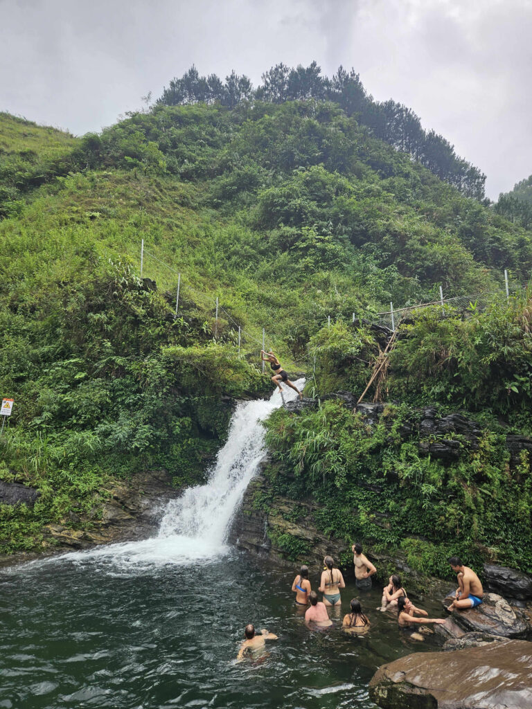
Cliff jumping at the mini waterfall!
Best tips to enjoy the Ha Giang Loop Map
1. To opt for a 3, 4 or 5-day Easy Rider tour?
As you speak to various tour operators and research online, you will see packages with various tour durations.
While the natural and scenic views are amazing in Ha Giang, I opted for the 3-day tour.
The reason being: that you will be riding at the back of a motorcycle. By the end of day 3, your glutes will start to hurt. I felt that riding any longer than 3 days would not bring me much more joy.
If you are afraid that you may be missing out on some of the best views on the Ha Giang Loop map, go for it!
The continuous long ride, covering a total of approximately 330km (205 miles) on a scooter
2. Do a weather check
The best months to enjoy the route on the Ha Giang Loop map are Spring (March to April) and Autumn (August to November).
If you have a very flexible travel schedule, I recommend you check the weather a few days ahead before making a reservation for the Easy Rider tour. While you may not be able to enjoy the best view of the region, it may not be less safe to ride on those winding roads.
I was in Ha Giang just as it was forecasted to rain for the week! I got lucky at the end of November!
Gloomy and cloudy skies of the Nho Quế River, 30 minutes before the clouds cleared up
3. Bring only the essentials!
As you are getting your Easy Rider tour package through one of the hostels in Ha Giang, I recommend leaving your 45L backpack in the storage room. Take only the essentials and cash for 3 days in your small backpack.
Why you may ask. Although the Easy Riders are skilful in riding the bikes through the winding roads, there are instances when the tie-down straps at the back of your bike give way. You do not want to lose all your backpacking items!
You’d be surprised, I’ve seen numerous 1.5L bottled water getting loose and rolling down the uphill roads! On some occasions, the bottles have rolled down too far and it is too dangerous and a bit too much hassle to make a u-turn to get them.
A backpack large enough to carry clothes for 3 days, tied to the back of our individual scooters
4. Cash
Breakfast, lunch and dinner will be served throughout the tour. However, I reckon there will be instances of random cravings at the grocery stores. Hence, the need for cash, in the event cards are not accepted.
There are ATMs in the major town, but it is not worth the hassle to find them.
5. Stay disconnected and connected
The views on the Ha Giang Loop map are spectacular and it is best not to miss any in the slightest. However, you may still want to connect with family and friends as you are as excited to share with them the best views. They will also want to know that you are safe.
WiFi is available at the accommodations that I stayed at. I had purchased a Vietnamese local sim card with Viettel and had no problem with the signal throughout the loop.
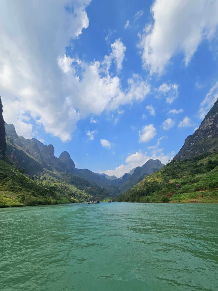
Turquoise coloured water of the Nho Quế River
Ready to enjoy the best experience of the Ultimate Ha Giang Loop Map?
There you have it. You get a great experience of the best viewpoints and routes on the Ultimate Ha Giang Loop Map.
This region of Vietnam has fewer tourists you will be able to enjoy the local culture in the various villages you ride through. There is minimal development for tourism, enabling you to enjoy the local experience.
While you will hear and see many comments highlighting that paying for an Easy Rider is expensive and you will not be able to thoroughly enjoy the loop, you might think otherwise after going for it yourself! The tour is not very expensive. You will thank yourself later as it removes the significant stress from riding through the winding, dusty roads.